ArcMap has a feature called "project on the fly". This mean ArcMap will try to project data into the spatial reference it is currently using to display data.
If the layer's spatial reference is correctly defined, the data will be projected, on the fly, correctly. Otherwise, it can end up somewhere else entirely.
In the image below, the county boundary for Humboldt County was loaded first. This layer had a spatial reference of NAD 27, State Plane California Zone I, Feet. You can tell this is a projected spatial reference because the lines between the states curve and the units are in feet.
Since the federal land shapefile did not have a spatial reference AND because its spatial reference did not match the current spatial reference, the data ended up in a completely incorrect location, off the coast of California (i.e. the entire federal lands for the US are in an area 360 x 180 feet off the coast of California).
When this data was loaded, I recieved a message that the layer had an "Unknown Spatial Reference" and I should have stopped then and made sure the spatial reference was correctly defined.
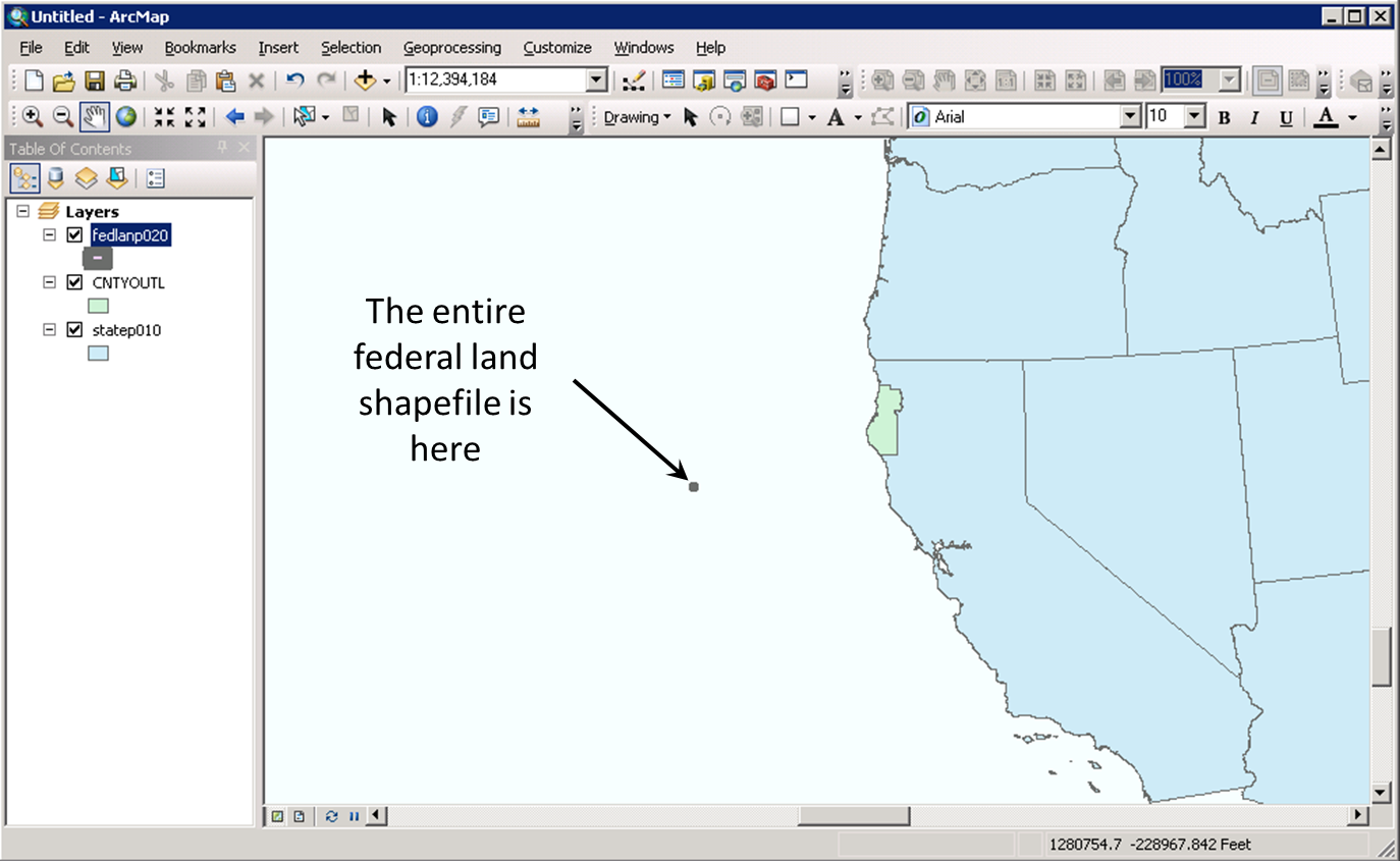
To make the situation worse, if I had just happened to load the federal lands shape file into ArcMap while it was using a spatial reference to display data that just happened to match the spatial reference of the federal lands shapefile, it would look like they were correctly defined.
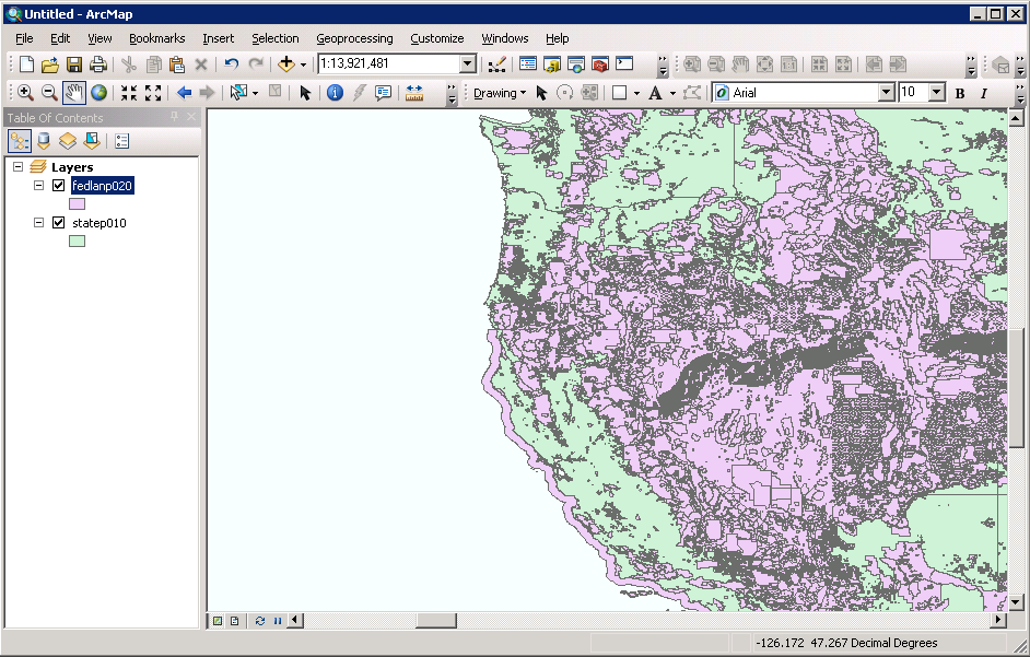
In the image below, I loaded the US States layer first. It's data is in WGS 84. You can tell ArcMap is not using a projected spatial reference because the units in the lower left are in degrees. When I added the Federal Lands shapefile, I still recieved the same error as before but now it looks like the data is correctly reference.
Bottom Line: Don't let project-on-the-fly fool you! Make sure you have the correct spatial reference defined for each data set.
© Copyright 2018 HSU - All rights reserved.